

-
Mills of Germany
Germany 1997.10.09
In issue: Stamp(s): 5
Issued in: sheets of 10 (5x2) stamps
-
1997-s-1-logo.jpg)
Number by catalogue: Michel: 1948 Yvert: 1780 Scott: B820
Perforation type: 13 ½x13 ½
Subject:
100+50 pfennings. Watermill from Black Forest*
Additional:
*The Black Forest (German: Schwarzwald) is a wooded mountain range in Baden-Württemberg, southwestern Germany. It is bordered by the Rhine valley to the west and south.
Geologically, the Black Forest consists of a cover of sandstone on top of a core of gneiss. During the last glacial period, the Würm glaciation, the Black Forest was covered by glaciers; several tarn lakes such as the Mummelsee are remains of this period.
The forest mostly consists of pines and firs, some of which are grown in commercial monoculture. The Black Forest, like other forested regions, has had areas damaged by mass logging. Due to logging and land use changes the forest proper is only a fraction of the size it used to be. The storm Lothar knocked down trees over hundreds of acres of mountaintops in 1999. This left some of the high peaks and scenic hills bare, with only primary growth shrubs and young fir trees.
The main industry is tourism. In addition to the towns and monuments noted below, the Black Forest is crossed by numerous long distance footpaths, including some of the first to be established. The European long-distance path E1 crosses the Black Forest following the routes of some of the local long-distance paths. In addition there are numerous shorter paths suitable for day walks, as well as mountain biking and cross-country skiing trails. The total network of tracks amounts to around 23,000 kilometres (14,000 mi), and is maintained and overseen by a voluntary body, the Schwarzwaldverein (Black Forest Society), which has around 90,000 members (figures from Bremke, 1999, p.9).Topics: Watermills
-
1997-s-2-logo.jpg)
Number by catalogue: Michel: 1949 Yvert: 1781 Scott: B821
Perforation type: 13 ½x13 ½
Subject:
100+50 pfennings. The Hesse* watermill
Additional:
*Hesse (German: Hessen) is a state of Germany with an area of 21,110 km² and just over six million inhabitants. The state capital is Wiesbaden. Hesse's largest city is nearby Frankfurt am Main. Hesse contributes the largest share to the Rhine Main Area.
Situated in west-central Germany, Hesse borders on the German states (starting from the northwest and proceeding clockwise) of North Rhine-Westphalia, Lower Saxony, Thuringia, Bavaria, Baden-Württemberg and Rhineland-Palatinate.
The most important rivers in Hesse are the Fulda and Eder rivers in the north, the Lahn in the central part of Hesse, and the Main and Rhine in the south. The countryside is hilly and there are numerous mountain ranges, like the Rhön, the Westerwald, the Taunus, the Vogelsberg, the Knüll or the Spessart.
Most of the population of Hesse is in the southern part of Hesse in the Rhine Main Area. The Rhine borders Hesse on the southwest without running through the state, only one old arm – the so-called Alt-Rhein – runs through Hesse. The mountain range between the Main and the Neckar river is called the Odenwald. The plain in between the rivers Main, Rhine and Neckar, and the Odenwald mountains is called the Ried.
Across the territory of Hesse runs 12 large and average rivers. Waters of the rivers always involved farmers to build the watermills.
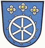
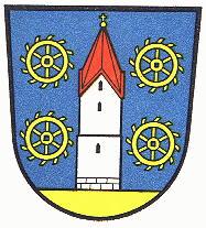
Some cities even included a water wheel of a mill in the coat of arms. The arms of cities are below resulted: Cappel, Muhlheimm am Main and Weiskirchen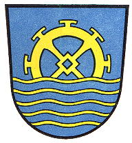
Topics: Watermills
-
Number by catalogue: Michel: 1950 Yvert: 1782 Scott: B822
Perforation type: 13 ½x13 ½
Subject:
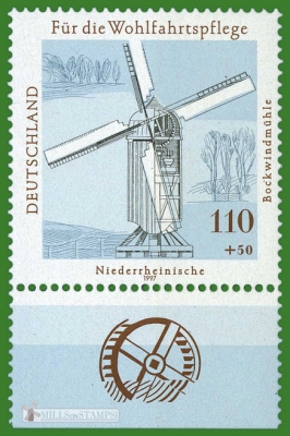
110+50 pfennings. Windmill from The Lower Rhine Region*
Additional:
*The Lower Rhine (German: Niederrhein, kilometers 660 to 1,033 of the Rhine River) flows from Bonn, Germany, to the North Sea. Almost immediately after entering the Netherlands, the Rhine splits into many branches.
Topics: Windmills
-
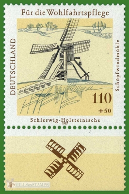
Number by catalogue: Michel: 1951 Yvert: 1783 Scott: B823
Perforation type: 13 ½x13 ½
Subject:
110+50 pfennings. The scoop type windmill from Schleswig-Holstein*
Additional:
*Schleswig-Holsteinis the northernmost of the sixteen states of Germany. Its capital city is Kiel, other notable cities are Lübeck and Flensburg.
Schleswig-Holstein borders Denmark to the north, the North Sea to the west, the Baltic Sea to the east, and the German states of Lower Saxony, Hamburg, and Mecklenburg-Vorpommern to the south.
The former English name was Sleswick-Holsatia, the Danish name is Slesvig-Holsten, the Low German name is Sleswig-Holsteen, and the North Frisian name is Slaswik-Holstiinj. Historically, the name can also refer to a larger region, containing both present-day Schleswig-Holstein and the former South Jutland County in Denmark.Topics: Windmills
-
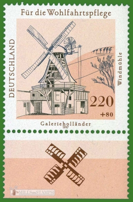
Number by catalogue: Michel: 1952 Yvert: 1784 Scott: B824
Perforation type: 13 ½x13 ½
Subject:
220+80 pfennings. The Dutch type windmill with gallery
Topics: Windmills